
Fruit Trees for Montana
These are the cold hardy fruit trees, berries and vines that grow in Montana, picked against real winter lows, not an average. Across the 36 areas we've mapped in Montana, the cold to plan for runs from −19°F on the warmest ground around Flathead and Mission Valleys to −56°F in the cold pockets around Choteau and the Rocky Mountain Front. Pick your area below and the list trims itself to what has come through that cold. Everything here ships bare root in spring 2027.
What fruit trees grow in Montana?
The best fruit trees for Montana are the ones that have already lived through the cold your spot gets. On typical Montana ground (−41°F, the middle of our mapped areas), 75 of the plants we're selling for spring 2027 have come through that cold: apples like Honeycrisp, Prairie Sensation, Frostbite and Haralson; pears like Larinskaya, Krazulya and Summercrisp; plums like Native American plum, Prairie Red and Mount Royal; tart and bush cherries like Romeo, Juliet and Nanking; apricots like Westcot and Manchurian. Berry bushes are the safest bet anywhere in the state.
Peaches are a stretch on most of the ground we've mapped in Montana. Siberian C peach has come through −35°F, so it's worth a try on the warmest ground in Flathead and Mission Valleys; Lower Clark Fork; and Missoula Valley. It ripens late, so give it your sunniest spot. Plant them up on a bench or slope, never the low spot.
For your exact address, the cold hardiness calculator gives you the number to plan for and every plant we grow that has survived it.
Pick your area of Montana
Showing all 252 plants that fit somewhere in Montana. Ones tagged "Warm spots only" need the warmest ground in the state.
148 plants fit most ground in Baker and Ekalaka (−39°F). The map runs −34°F to −44°F there, so open the map for Baker and Ekalaka to get the number at your place.
148 plants fit most ground in Big Sky and the Gallatin Canyon (−40°F). The map runs −37°F to −42°F there, so open the map for Big Sky and the Gallatin Canyon to get the number at your place.
148 plants fit most ground in Big Timber, Columbus and Park City (−37°F). The map runs −33°F to −41°F there, so open the map for Big Timber, Columbus and Park City to get the number at your place.
194 plants fit most ground in Billings (−34°F). The map runs −30°F to −52°F there, so open the map for Billings to get the number at your place.
239 plants fit most ground in Bitterroot Valley (−28°F). The map runs −27°F to −32°F there, so open the map for Bitterroot Valley to get the number at your place.
75 plants fit most ground in Blackfoot Valley and Seeley Lake (−45°F). The map runs −26°F to −52°F there, so open the map for Blackfoot Valley and Seeley Lake to get the number at your place.
75 plants fit most ground in Browning and East Glacier (−41°F). The map runs −38°F to −46°F there, so open the map for Browning and East Glacier to get the number at your place.
148 plants fit most ground in Butte, Anaconda and Deer Lodge (−40°F). The map runs −38°F to −46°F there, so open the map for Butte, Anaconda and Deer Lodge to get the number at your place.
75 plants fit most ground in Choteau and the Rocky Mountain Front (−41°F). The map runs −37°F to −56°F there, so open the map for Choteau and the Rocky Mountain Front to get the number at your place.
148 plants fit most ground in Dillon, Jefferson and Ruby Valleys (−39°F). The map runs −36°F to −46°F there, so open the map for Dillon, Jefferson and Ruby Valleys to get the number at your place.
194 plants fit most ground in Flathead and Mission Valleys (−33°F). The map runs −19°F to −48°F there, so open the map for Flathead and Mission Valleys to get the number at your place.
75 plants fit most ground in Fort Benton and the Upper Missouri (−41°F). The map runs −38°F to −51°F there, so open the map for Fort Benton and the Upper Missouri to get the number at your place.
75 plants fit most ground in Gallatin Valley (Bozeman) (−42°F). The map runs −41°F to −47°F there, so open the map for Gallatin Valley (Bozeman) to get the number at your place.
75 plants fit most ground in Glasgow, Fort Peck and Wolf Point (−42°F). The map runs −41°F to −47°F there, so open the map for Glasgow, Fort Peck and Wolf Point to get the number at your place.
148 plants fit most ground in Great Falls and the Sun River (−40°F). The map runs −36°F to −46°F there, so open the map for Great Falls and the Sun River to get the number at your place.
75 plants fit most ground in Hardin, Hysham and Forsyth (−42°F). The map runs −34°F to −51°F there, so open the map for Hardin, Hysham and Forsyth to get the number at your place.
51 plants fit most ground in Havre and the Hi-Line (−46°F). The map runs −39°F to −50°F there, so open the map for Havre and the Hi-Line to get the number at your place.
75 plants fit most ground in Helena Valley (−42°F). The map runs −38°F to −46°F there, so open the map for Helena Valley to get the number at your place.
75 plants fit most ground in Jordan and the Big Dry (−42°F). The map runs −34°F to −47°F there, so open the map for Jordan and the Big Dry to get the number at your place.
75 plants fit most ground in Lewistown and the Judith Basin (−41°F). The map runs −38°F to −51°F there, so open the map for Lewistown and the Judith Basin to get the number at your place.
148 plants fit most ground in Libby, Eureka and the Kootenai (−37°F). The map runs −26°F to −46°F there, so open the map for Libby, Eureka and the Kootenai to get the number at your place.
51 plants fit most ground in Lincoln and the upper Blackfoot (−50°F). The map runs −47°F to −53°F there, so open the map for Lincoln and the upper Blackfoot to get the number at your place.
239 plants fit most ground in Lower Clark Fork (Plains, Thompson Falls) (−29°F). The map runs −21°F to −38°F there, so open the map for Lower Clark Fork (Plains, Thompson Falls) to get the number at your place.
75 plants fit most ground in Miles City and Glendive (−41°F). The map runs −37°F to −46°F there, so open the map for Miles City and Glendive to get the number at your place.
239 plants fit most ground in Missoula Valley (−28°F). The map runs −24°F to −38°F there, so open the map for Missoula Valley to get the number at your place.
148 plants fit most ground in Paradise Valley and Livingston (−40°F). The map runs −29°F to −48°F there, so open the map for Paradise Valley and Livingston to get the number at your place.
148 plants fit most ground in Philipsburg and Flint Creek (−40°F). The map runs −36°F to −48°F there, so open the map for Philipsburg and Flint Creek to get the number at your place.
75 plants fit most ground in Plentywood and Scobey (−44°F). The map runs −41°F to −49°F there, so open the map for Plentywood and Scobey to get the number at your place.
194 plants fit most ground in Red Lodge and the Beartooth Front (−35°F). The map runs −30°F to −42°F there, so open the map for Red Lodge and the Beartooth Front to get the number at your place.
75 plants fit most ground in Roundup, Harlowton and the Musselshell (−43°F). The map runs −36°F to −51°F there, so open the map for Roundup, Harlowton and the Musselshell to get the number at your place.
75 plants fit most ground in Shelby, Cut Bank and the Sweet Grass Hills (−42°F). The map runs −37°F to −48°F there, so open the map for Shelby, Cut Bank and the Sweet Grass Hills to get the number at your place.
75 plants fit most ground in the Big Hole Valley (−41°F). The map runs −35°F to −54°F there, so open the map for the Big Hole Valley to get the number at your place.
148 plants fit most ground in Townsend, Boulder and the Broadwater Valley (−39°F). The map runs −33°F to −47°F there, so open the map for Townsend, Boulder and the Broadwater Valley to get the number at your place.
148 plants fit most ground in West Yellowstone and Island Park (−40°F). The map runs −36°F to −52°F there, so open the map for West Yellowstone and Island Park to get the number at your place.
75 plants fit most ground in White Sulphur Springs and the Smith River (−45°F). The map runs −39°F to −50°F there, so open the map for White Sulphur Springs and the Smith River to get the number at your place.
75 plants fit most ground in Williston and Sidney (MonDak) (−43°F). The map runs −40°F to −47°F there, so open the map for Williston and Sidney (MonDak) to get the number at your place.
Apple Trees for Montana
 Honeycrisp AppleZone 2b · −45°Ffrom $59.99
 Prairie Sensation AppleZone 2 · −50°Ffrom $54.99
 Frostbite AppleZone 2b · −45°Ffrom $59.99
 Haralson AppleZone 2b · −45°Ffrom $54.99
 Zestar!® AppleZone 3 · −40°Ffrom $59.99
 Arkansas Black AppleZone 3 · −40°Ffrom $44.99
 Carroll AppleZone 2 · −50°Ffrom $49.99
 Norkent AppleZone 2 · −50°Ffrom $54.99


Show more apple trees
 Liberty AppleZone 3b · −35°Ffrom $49.99
 Dearborn's Unknown AppleZone 2 · −50°Ffrom $59.99
 Kindercrisp AppleZone 2 · −50°Ffrom $44.99
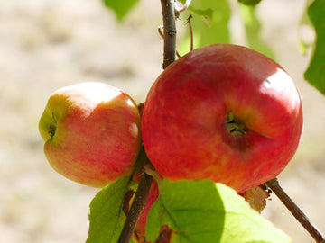 Goodland AppleZone 2b · −45°Ffrom $44.99
 Fred's Mac AppleZone 3 · −40°Ffrom $59.99
 Wolf River AppleZone 2 · −50°Ffrom $49.99
 Norda AppleZone 2 · −50°Ffrom $54.99
 Tropical Winter AppleZone 3 · −40°Ffrom $44.99
 Pink Pearl AppleZone 3b · −35°Ffrom $74.99
 Empire AppleZone 3b · −35°Ffrom $34.99
 Golden Russet AppleZone 3 · −40°Ffrom $44.99
 Evercrisp AppleZone 4 · −30°Ffrom $59.99
 Ribston Pippin Cider AppleZone 3b · −35°Ffrom $49.99
 Norland AppleZone 2 · −50°Ffrom $49.99
 Airlie Red Flesh AppleZone 3b · −35°Ffrom $64.99
 Spokane Beauty AppleZone 3b · −35°Ffrom $89.99
 Blue Pearmain AppleZone 3b · −35°Ffrom $39.99
 Spartan AppleZone 3 · −40°Ffrom $59.99
 Parkland AppleZone 1 · −60°Ffrom $74.99
 Northern Spy AppleZone 4 · −30°Ffrom $39.99
 Glockenapfel AppleZone 4b · −25°Ffrom $74.99Warm spots only
 Cortland AppleZone 3 · −40°Ffrom $44.99
 Newtown Pippin AppleZone 4 · −30°Ffrom $44.99
 September Ruby AppleZone 2 · −50°Ffrom $49.99
 William's Pride AppleZone 3b · −35°Ffrom $74.99
 Lodi AppleZone 2b · −45°Ffrom $54.99
 Wealthy AppleZone 2 · −50°Ffrom $59.99
 Pristine AppleZone 4 · −30°Ffrom $49.99
 Roxbury Russet AppleZone 4 · −30°Ffrom $89.99
 Prairie Spy AppleZone 3 · −40°Ffrom $59.99
 Macoun AppleZone 3b · −35°Ffrom $59.99
 Gravenstein AppleZone 2b · −45°Ffrom $54.99
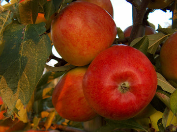 Sweet Sixteen AppleZone 3 · −40°Ffrom $44.99
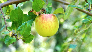 9-22 End AppleZone 2b · −45°Ffrom $44.99
 Ashmead's Kernel AppleZone 3b · −35°Ffrom $89.99
 Wise Monkey AppleZone 4 · −30°Ffrom $44.99
 Spartan x Mac Apple Seedling (Bundle of 2)Zone 3 · −40°Ffrom $59.99
 MN 1628 AppleZone 3 · −40°Ffrom $89.99
 Six Finger Jack AppleZone 4 · −30°Ffrom $59.99
 Northfield Beauty AppleZone 3 · −40°Ffrom $49.99
 Cox Orange Pippin AppleZone 3b · −35°Ffrom $59.99
 Hunt Russet AppleZone 4 · −30°Ffrom $84.99
 Belle de Boskoop AppleZone 4 · −30°Ffrom $89.99
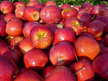 Spencer AppleZone 3 · −40°Ffrom $49.99
 Red Baron AppleZone 3 · −40°Ffrom $74.99
 Northwest Greening AppleZone 3 · −40°Ffrom $49.99
 Crimson Beauty AppleZone 3 · −40°Ffrom $59.99
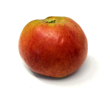 Alexander AppleZone 3 · −40°Ffrom $49.99
 Pink Princess AppleZone 4 · −30°Ffrom $44.99
 Lubsk Queen AppleZone 4 · −30°Ffrom $39.99
 Karmijn de Sonnaville AppleZone 4 · −30°Ffrom $44.99
 Dolores River Sorbet AppleZone 4 · −30°Ffrom $49.99
 Binet Rouge AppleZone 3 · −40°Ffrom $74.99
 Triumph AppleZone 3b · −35°Ffrom $44.99
 Paula Red AppleZone 3 · −40°Ffrom $59.99
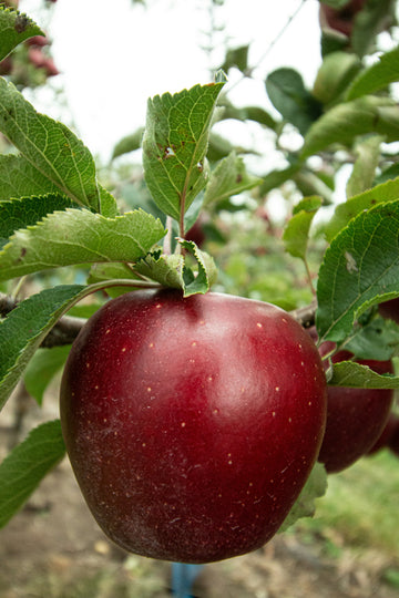 Thunderbolt AppleZone 4 · −30°Ffrom $49.99
 Sunrise (Canada) AppleZone 3b · −35°Ffrom $44.99
 Oriole AppleZone 2 · −50°Ffrom $49.99
 Margil AppleZone 4 · −30°Ffrom $44.99
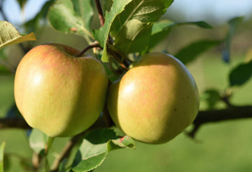 Malinda AppleZone 3 · −40°Ffrom $44.99
 Colorado Orange AppleZone 3b · −35°Ffrom $49.99
 Black Oxford AppleZone 3b · −35°Ffrom $44.99
 Laxton's Favorite AppleZone 4 · −30°Ffrom $54.99
 Claygate Pearmain AppleZone 4 · −30°Ffrom $89.99
 Brown Snout AppleZone 4 · −30°Ffrom $89.99
 St. Edmund's Pippin AppleZone 5 · −20°Ffrom $44.99Warm spots only
 Shafer AppleZone 2 · −50°Ffrom $49.99
 Sandow AppleZone 3 · −40°Ffrom $44.99
 Rhuby AppleZone 2 · −50°Ffrom $49.99
 Reinette Simirenko AppleZone 3b · −35°Ffrom $44.99
 Redstar AppleZone 2b · −45°Ffrom $39.99
 Red Sparkle AppleZone 2b · −45°Ffrom $49.99
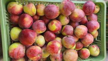 Mother AppleZone 3b · −35°Ffrom $44.99
 Autumn Strawberry AppleZone 4 · −30°Ffrom $49.99
 Kandil Sinap AppleZone 5 · −20°Ffrom $44.99Warm spots only
 Clayton Berg AppleZone 2 · −50°Ffrom $44.99
 Cherry Cox AppleZone 4 · −30°Ffrom $49.99
 Burgundy AppleZone 2b · −45°Ffrom $49.99
 Swiss Gourmet (aka Arlet) AppleZone 3 · −40°Ffrom $84.99
 Mantet AppleZone 2 · −50°Ffrom $49.99
 Franklin Cider AppleZone 3 · −40°Ffrom $59.99
 Tolman Sweet AppleZone 4 · −30°Ffrom $59.99
 Swiss Limbertwig AppleZone 4 · −30°Ffrom $44.99
 Starkey AppleZone 4 · −30°Ffrom $59.99
 Nova Easygro AppleZone 3b · −35°Ffrom $49.99
 Yates AppleZone 4 · −30°Ffrom $74.99
 Ellis Bitter AppleZone 4 · −30°Ffrom $74.99


See all apple trees, zone 2 apple trees, zone 3 apple trees, zone 4 apple trees, zone 5 apple trees.
Crabapples and Applecrabs for Montana
 Kerr ApplecrabZone 2 · −50°Ffrom $54.99
 Trailman ApplecrabZone 1b · −55°Ffrom $54.99
 Dolgo Crabapple (Bundle of 2)Zone 1b · −55°Ffrom $74.99
 Centennial ApplecrabZone 2 · −50°Ffrom $59.99
 Martha ApplecrabZone 3 · −40°Ffrom $44.99
 Chestnut ApplecrabZone 2 · −50°Ffrom $59.99
 Rescue ApplecrabZone 1 · −60°Ffrom $49.99
 Hewe's Virginia CrabappleZone 3b · −35°Ffrom $74.99


Show more crabapples and applecrabs


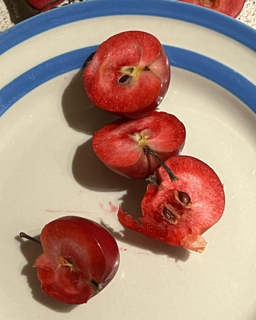
See all crabapples and applecrabs, zone 2 crabapples, zone 3 crabapples.
Pear Trees for Montana
 Larinskaya PearZone 2b · −45°Ffrom $44.99
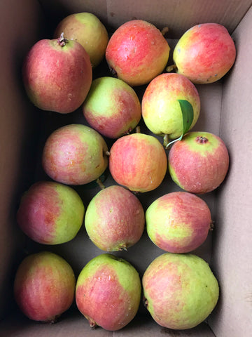 Krazulya PearZone 2 · −50°Ffrom $44.99
 Bartlett PearZone 3b · −35°Ffrom $64.99
 Summercrisp PearZone 2b · −45°Ffrom $34.99
 Seckel PearZone 3b · −35°Ffrom $109.99
 Vekovaya PearZone 2b · −45°Ffrom $49.99
 Luscious PearZone 3 · −40°Ffrom $49.99
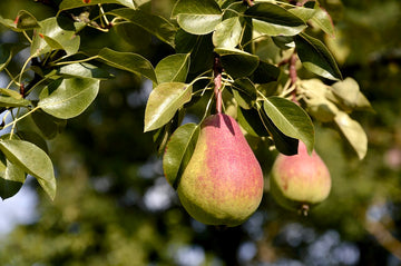 Ubileen PearZone 4 · −30°Ffrom $34.99


Show more pear trees
 Stuttgarter Gaishirtle PearZone 3b · −35°Ffrom $49.99
 Nova PearZone 3 · −40°Ffrom $49.99
 Bolshaya PearZone 2 · −50°Ffrom $34.99
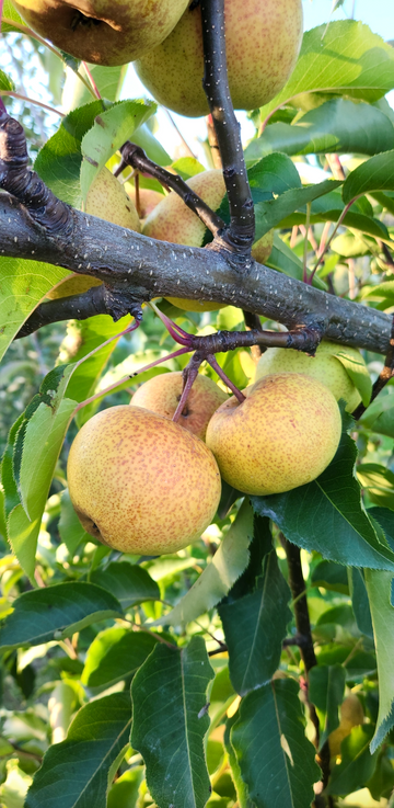 Taylor Apple PearZone 2b · −45°Ffrom $39.99
 Ure PearZone 2b · −45°Ffrom $49.99
 Savignac PearZone 3 · −40°Ffrom $44.99
 Frost PearZone 3 · −40°Ffrom $34.99
 Hudar PearZone 3 · −40°Ffrom $44.99
 Cold Snap® PearZone 3 · −40°Ffrom $34.99
 Honeysweet PearZone 4 · −30°Ffrom $49.99
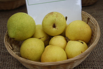 Clara Frijs PearZone 3b · −35°Ffrom $49.99
 Bulgaria PearZone 2 · −50°Ffrom $49.99
 Waterville PearZone 3 · −40°Ffrom $39.99
 D'Anjou PearZone 4 · −30°Ffrom $64.99
 Vermont Beauty PearZone 3 · −40°Ffrom $49.99
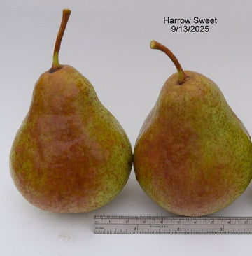 Harrow Sweet PearZone 4 · −30°Ffrom $34.99
 Golden Russet Bosc PearZone 4 · −30°Ffrom $64.99
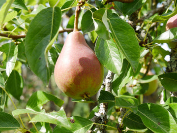 Clapp's Favorite PearZone 4 · −30°Ffrom $49.99


See all pear trees, zone 2 pear trees, zone 3 pear trees, zone 4 pear trees.
Plum Trees for Montana
 Italian PlumZone 3b · −35°Ffrom $74.99
 Tipson PlumcotZone 4 · −30°Ffrom $49.99
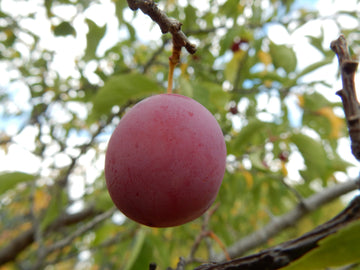 Native American Plum (Bundle of 3)Zone 2 · −50°Ffrom $99.99Native
 Prairie Red Plum (Bundle of 2)Zone 2 · −50°Ffrom $74.99
 Mount Royal PlumZone 2b · −45°Ffrom $49.99
 La Crescent PlumZone 3 · −40°Ffrom $109.99
 Underwood PlumZone 3 · −40°Ffrom $64.99
 Toka PlumZone 2b · −45°Ffrom $49.99


Show more plum trees
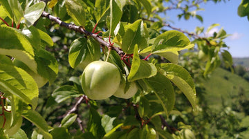 Ptitsin #5 PlumZone 2 · −50°Ffrom $54.99
 Mirabelle de Bitterroot Plum (Bundle of 2)Zone 3b · −35°Ffrom $99.99
 Superior PlumZone 3b · −35°Ffrom $49.99
 Pipestone PlumZone 3 · −40°Ffrom $59.99
 Kuban Delight PlumZone 3b · −35°Ffrom $109.99
 Black Ice PlumZone 3 · −40°Ffrom $44.99
 Benson's Gem PlumZone 3b · −35°Ffrom $44.99
 Gracious PlumZone 3 · −40°Ffrom $59.99
 Kahinta PlumZone 3 · −40°Ffrom $79.99
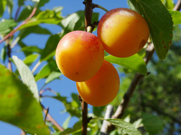 Brookgold PlumZone 2 · −50°Ffrom $59.99
 Deluge PlumZone 3b · −35°Ffrom $59.99
 Kaga PlumZone 3 · −40°Ffrom $54.99


Cherry Trees and Bush Cherries for Montana
 Lapins Sweet CherryZone 3b · −35°Ffrom $64.99
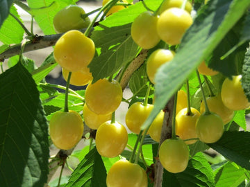 Gold Sweet CherryZone 3b · −35°Ffrom $64.99
 Black Gold Sweet CherryZone 3b · −35°Ffrom $64.99
 White Gold Sweet CherryZone 3b · −35°Ffrom $64.99
 Rainier Sweet CherryZone 4 · −30°Ffrom $64.99
 Montmorency Tart CherryZone 3b · −35°Ffrom $64.99
 Romeo Dwarf Cherry (Bundle of 2)Zone 2 · −50°Ffrom $99.99
 Juliet Dwarf Cherry (Bundle of 2)Zone 2 · −50°Ffrom $99.99


Show more cherry trees and bush cherries
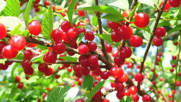 Nanking Cherry (Bundle of 3)Zone 2 · −50°Ffrom $79.99
 Evan's Bali Tart CherryZone 2b · −45°Ffrom $54.99
 Sand Cherry (Bundle of 3)Zone 2 · −50°Ffrom $79.99Native
 Ian White Nanking Cherry (Bundle of 2)Zone 2 · −50°Ffrom $54.99
 Meteor Tart CherryZone 3 · −40°Ffrom $119.99
 Jules Nanking Cherry (Bundle of 2)Zone 2 · −50°Ffrom $54.99
 Chokecherry (Bundle of 3)Zone 2 · −50°Ffrom $89.99Native
 Balaton Tart CherryZone 3b · −35°Ffrom $64.99
 Jan Bush Cherry (Bundle of 2)Zone 3b · −35°Ffrom $54.99
 Joy Bush Cherry (Bundle of 2)Zone 3b · −35°Ffrom $54.99
 Joel Bush Cherry (Bundle of 2)Zone 3b · −35°Ffrom $59.99
 FE Tart CherryZone 2b · −45°Ffrom $49.99


See all cherry trees and bush cherries, zone 2 cherry trees, zone 3 cherry trees.
Apricot Trees for Montana
 Westcot ApricotZone 2b · −45°Ffrom $49.99
 Manchurian Apricot (Bundle of 2)Zone 2b · −45°Ffrom $69.99
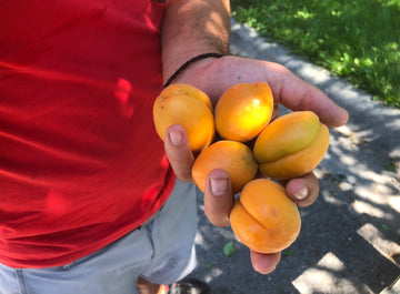 Morden 604 ApricotZone 2b · −45°Ffrom $49.99
 Zard Apricot Seedling (Bundle of 2)Zone 4 · −30°Ffrom $99.99
 Debbie's Gold ApricotZone 2b · −45°Ffrom $54.99
 Alice Sharp ApricotZone 3b · −35°Ffrom $44.99
 Morden 604 Apricot Seedling (Bundle of 2)Zone 2b · −45°Ffrom $89.99
 Bill's Nectar PeachcotZone 4 · −30°Ffrom $59.99


Show more apricot trees


See all apricot trees, zone 2 apricot trees, zone 3 apricot trees, zone 4 apricot trees.
Peach and Nectarine Trees for Montana
 Contender PeachZone 4 · −30°Ffrom $54.99
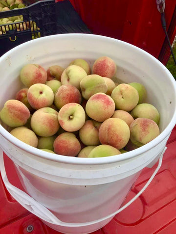 Siberian C Peach Seedling (Bundle of 2)Zone 3b · −35°Ffrom $109.99
 Blushingstar PeachZone 4 · −30°Ffrom $54.99
 Hardired NectarineZone 4b · −25°Ffrom $44.99Warm spots only
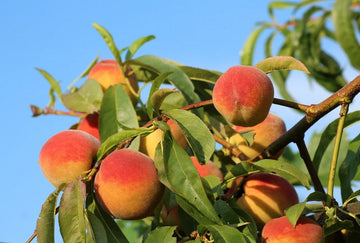 Risingstar PeachZone 4b · −25°Ffrom $54.99Warm spots only
 Fantasia NectarineZone 5 · −20°Ffrom $64.99Warm spots only
 Glowingstar PeachZone 4b · −25°Ffrom $64.99Warm spots only
 Mericrest NectarineZone 5 · −20°Ffrom $44.99Warm spots only


Show more peach and nectarine trees


See all peach and nectarine trees, zone 3 peach trees, zone 4 peach trees.
Berry Bushes for Montana
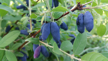 Honeyberry (Bundle of 4)Zone 2 · −50°Ffrom $139.99
 Cold Climate Blueberry Bundle (Bundle of 3)Zone 3 · −40°Ffrom $99.99
 Sea Buckthorn (Bundle of 5)Zone 2 · −50°Ffrom $119.99
 Anne Yellow Raspberry (Bundle of 5)Zone 3 · −40°Ffrom $79.99
 Huckleberry (Bundle of 3)Zone 3 · −40°Ffrom $89.99Native
 Nova Raspberry (Bundle of 5)Zone 2 · −50°Ffrom $79.99
 Honeoye Strawberry (Bundle of 25)Zone 2 · −50°Ffrom $74.99
 Boyne Raspberry (Bundle of 5)Zone 2 · −50°Ffrom $79.99


Show more berry bushes
 American Elderberry (Bundle of 3)Zone 2 · −50°Ffrom $79.99Native
 Polana Raspberry (Bundle of 5)Zone 3 · −40°Ffrom $79.99
 Cavendish Strawberry (Bundle of 25)Zone 3 · −40°Ffrom $74.99
 Montana Black Currant (Bundle of 3)Zone 2 · −50°Ffrom $89.99Native
 Serviceberry (Bundle of 5)Zone 2 · −50°Ffrom $99.99Native
 Golden Currant (Bundle of 3)Zone 2 · −50°Ffrom $89.99Native
 Adam's Elderberry (Bundle of 2)Zone 3 · −40°Ffrom $59.99
 John's Elderberry (Bundle of 2)Zone 3 · −40°Ffrom $59.99
 Buffaloberry (Bundle of 5)Zone 2 · −50°Ffrom $99.99Native
 Annapolis Strawberry (Bundle of 25)Zone 3 · −40°Ffrom $74.99
 AC Wendy Strawberry (Bundle of 25)Zone 3 · −40°Ffrom $74.99
 Sparkle Strawberry (Bundle of 25)Zone 3 · −40°Ffrom $74.99
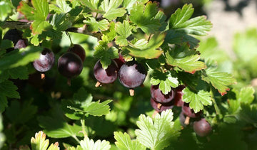 Black Velvet Gooseberry (Bundle of 2)Zone 3 · −40°Ffrom $59.99
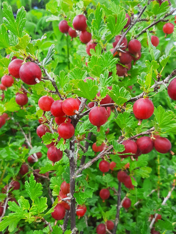 Hinnomaki Red Gooseberry (Bundle of 2)Zone 3 · −40°Ffrom $59.99
 Goji Berry (Bundle of 3)Zone 3 · −40°Ffrom $79.99
 Aronia Berry (Bundle of 3)Zone 2 · −50°Ffrom $79.99Native
 Jostaberry (Bundle of 3)Zone 3b · −35°Ffrom $59.99
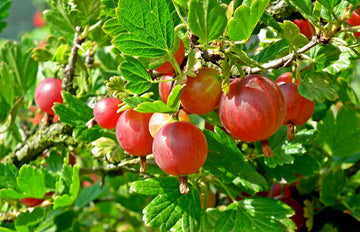 Jahn's Prairie Gooseberry (Bundle of 2)Zone 3 · −40°Ffrom $59.99
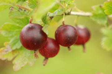 Jeanne Gooseberry (Bundle of 2)Zone 3 · −40°Ffrom $59.99
 Red Lake Currant (Bundle of 2)Zone 3 · −40°Ffrom $54.99
 Titania Black Currant (Bundle of 2)Zone 3 · −40°Ffrom $54.99
 Captivator Gooseberry (Bundle of 2)Zone 3 · −40°Ffrom $59.99
 Royalty Purple Raspberry (Bundle of 3)Zone 4 · −30°Ffrom $74.99


See all berry bushes, zone 2 berries, shrubs and vines, zone 3 berries, shrubs and vines, zone 4 berries, shrubs and vines.
Grapes and Hardy Kiwi for Montana
 Somerset Seedless Grape (Bundle of 2)Zone 3 · −40°Ffrom $59.99
 Valiant Grape (Bundle of 2)Zone 2 · −50°Ffrom $59.99
 Bluebell Grape (Bundle of 2)Zone 2 · −50°Ffrom $59.99
 Swenson Red Grape (Bundle of 2)Zone 4 · −30°Ffrom $59.99
 Marquette Grape (Bundle of 2)Zone 3b · −35°Ffrom $59.99
 Itasca Grape (Bundle of 2)Zone 3b · −35°Ffrom $59.99
 Frontenac Grape (Bundle of 2)Zone 3b · −35°Ffrom $59.99
 Concord Grape (Bundle of 2)Zone 4 · −30°Ffrom $59.99


Show more grapes and hardy kiwi

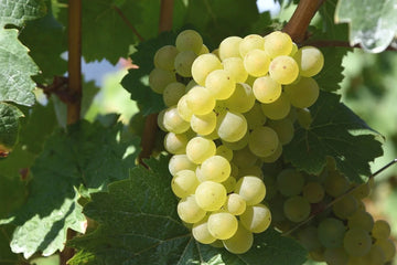


Nut Trees for Montana
 American Hazelnut (Bundle of 3)Zone 3 · −40°Ffrom $79.99
 Purvis Hardy English Walnut (Bundle of 2)Zone 4b · −25°Ffrom $79.99Warm spots only
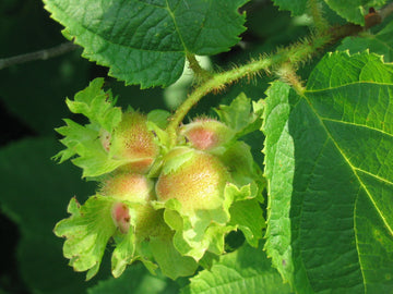 Cortland Hybrid Hazelnut Seedling (Bundle of 3)Zone 3b · −35°Ffrom $99.99
 Black Walnut (Bundle of 3)Zone 3 · −40°Ffrom $99.99
 Ultra Northern English Walnut (Bundle of 2)Zone 4b · −25°Ffrom $119.99Warm spots only


See all nut trees.
Unusual Fruit for Montana
 Trader Mulberry (Bundle of 2)Zone 3 · −40°Ffrom $89.99
 Montana Trial Pawpaw (Bundle of 2)Zone 4 · −30°Ffrom $79.99
 Montana Trial Persimmon (Bundle of 5)Zone 4b · −25°Ffrom $149.99NativeWarm spots only
 Hawthorn (Bundle of 3)Zone 3 · −40°Ffrom $79.99
 Ivan's Beauty Aronia x Mtn. AshZone 3 · −40°Ffrom $49.99
 Mountain Ash (Bundle of 3)Zone 3 · −40°Ffrom $99.99Native
 Aromatnaya Russian QuinceZone 4 · −30°Ffrom $49.99
 Ravalli QuinceZone 4 · −30°Ffrom $34.99


Show more unusual fruit

See all unusual fruit.
What our microclimate maps found in Montana
We've mapped 36 fruit growing areas in Montana, down to the bench and the draw. Here's the short version of what turned up, all pulled from the maps themselves. Click any area to open its full map.
36areas mapped in Montana
−19°Fwarmest ground we've mapped, in Flathead and Mission Valleys
−56°Fcoldest pocket we've mapped, in Choteau and the Rocky Mountain Front
−66°Fcoldest reading on our Montana maps, West Yellowstone, February 9, 1933
23 to 156frost free days, from the Big Hole Valley to Billings
1. Still, clear nightThe ground loses heat and the air touching it gets cold and heavy.
2. Cold air drainsIt slides downhill like water, down draws and creeks.
3. It pools lowRiver bottoms, flats and basins fill up and read coldest.
4. Benches stay warmerSlopes and benches above the pool run warmer, in winter and at bloom.
How cold each area gets
Each bar runs from an area's warmest growing ground (left) to its coldest bottoms (right). The black mark is the planning low for most of its ground.
Show all 36 areas
−10°F−20°F−30°F−40°F−50°F−60°F
warm ground to cold groundmost ground plans for
How long the frost free season runs
Days between the average last spring frost and first fall frost, at the station each map uses.
Show all 33 areas
What stood out on each map
Flathead and Mission ValleysOn January 13, 2024, Creston hit −39°F while Blue Bay on Flathead Lake's east shore read −13°F.
Blackfoot Valley and Seeley LakeOn January 14, 2024 Potomac hit −47°F while the Missoula airport only fell to −22°F, a 25°F gap, so the lower end plants like Missoula and the upper basins need the hardiest things.
BillingsOn January 13, 2024 the Billings airport on the Rims read −26°F, the weather office on the floor read −31°F, and the Huntley Experiment Station down the river read −52°F.
Libby, Eureka and the KootenaiOn December 30, 1968, Eureka hit −50°F while Troy, down on the Kootenai, bottomed out at −35°F.
Choteau and the Rocky Mountain FrontFairfield once went from 63°F to −21°F in twelve hours, and the planning low ranges from −37°F at Fairfield to −56°F in the Augusta basin.
Paradise Valley and LivingstonGardiner plans for −29°F while Livingston, nearly 800 feet lower, plans for −40°F, so the warm end of the map is the high end.
See what the other 30 Montana maps found
The Big Hole ValleyWisdom's median frost-free season is only 23 days, from July 7 to July 20, and its station hit −55°F on December 23, 1983.
Hardin, Hysham and ForsythOn December 22, 1989, the Badger Peak station read −24°F while Busby, down on upper Rosebud Creek, read −52°F, a 28°F inversion on one night.
Lower Clark Fork (Plains, Thompson Falls)On January 13, 2024, Hot Springs hit −33°F while Thompson Falls, down on the river, bottomed out at −22°F, an 11°F gap.
West Yellowstone and Island ParkWest Yellowstone hit −66°F on February 9, 1933, the lowest on record for any residential community in the lower 48, and gets a median of only 28 frost-free days.
Roundup, Harlowton and the MusselshellRoundup hit −52°F on February 15, 1936, and the map plans for −51°F on the river bottom at Bundy.
Missoula ValleyOn January 13, 2024 the Missoula airport hit −22°F while Stevensville hit −40°F, and inside the valley the growing ground plans for between −24°F and −32°F.
Townsend, Boulder and the Broadwater ValleyOn February 2, 1996 the Townsend station on the Missouri River floor read −38°F while the Ginger station, 7 miles away and about 400 feet higher, read −26°F, a 12°F split.
Fort Benton and the Upper MissouriLoma read −54°F on January 14, 1972, and a chinook had it at 49°F the next morning, a rise of 103°F in 24 hours, the US record.
Jordan and the Big DryOn February 14, 1936, Jordan hit −58°F while the old Haxby station 20 miles northeast read −39°F.
Lewistown and the Judith BasinThe basin splits sharply: the map plans for −46°F in Lewistown, −38°F and −39°F at Stanford and Moccasin, and −47°F down the Judith at Denton.
Philipsburg and Flint CreekThis valley gets colder going downstream: Drummond, 1,300 feet lower than Philipsburg, plans for −48°F against −39°F in town.
Red Lodge and the Beartooth FrontBridger plans for −33°F while Columbus, less than 30 miles away on the Yellowstone river bottom, plans for −41°F.
Havre and the Hi-LineIn the 1969 outbreak the Rocky Boy station on the Bears Paw read −29°F while the Havre airport hit −52°F on January 24.
Shelby, Cut Bank and the Sweet Grass HillsOn January 13, 2024, Chester hit −54°F while Shelby, 40 miles west, read −37°F.
White Sulphur Springs and the Smith RiverIn the January 2024 cold snap White Sulphur Springs hit −46°F and Deadman Creek −48°F, while Pickfoot Creek, 1,600 feet higher, stopped at −38°F.
Baker and EkalakaPlevna, down on O'Fallon Creek, holds the deepest record inside the map at −52°F while Ekalaka, higher up, has a record of −44°F.
Dillon, Jefferson and Ruby ValleysOn January 13, 2024, Dillon hit −41°F and broke its all-time record low.
Great Falls and the Sun RiverOn January 11, 1980, Great Falls went from −32°F to +15°F in seven minutes, and the Southside plans for −36°F while Fort Shaw and Simms plan for −45°F and −46°F.
Miles City and GlendiveSince 1938 the Miles City airport on Airport Hill has never dropped below −38°F, but the old in-town station hit −49°F on February 11, 1899.
Big Timber, Columbus and Park CityColumbus hit −38°F on January 13, 2024 while Big Timber, 500 ft higher, bottomed at −30°F, so cold drains to the river bottom and height above it beats elevation.
Browning and East GlacierOn January 23, 1916 Browning had a high of 44°F and the next morning it was −56°F, a 100°F drop in a day that's often cited as a world record.
Butte, Anaconda and Deer LodgeButte's airport has hit −52°F twice while Anaconda's coldest on record is −38°F, and in five big outbreaks Anaconda ran 8 to 14°F warmer than the airport.
Helena ValleyDowntown and the Mansion District, half a mile apart, differ by 13°F on a still spring bloom night.
Plentywood and ScobeyOn February 8, 2019 the Scobey 4 NW station read −51°F while the upland Wolf Point 34 NE station read −24°F in the same outbreak.
Williston and Sidney (MonDak)In 2025 NDSU's research plot on the Missouri bottom got 112 frost-free days while their upland farm by Williston got 159.
Gallatin Valley (Bozeman)On January 13, 2024, the MSU campus read −40°F and the Belgrade airport −45°F, nine miles apart.
Glasgow, Fort Peck and Wolf PointOn January 26, 1950, the Missouri bottom at Wolf Point hit −57°F while Lustre, up on the plain, read −38°F.
Lincoln and the upper BlackfootOn January 13, 2024 the Lincoln station read −53°F while snow stations 2,400 feet higher bottomed out at −39°F in the same cold snap.
Big Sky and the Gallatin CanyonOn February 6, 2014 the old Big Sky station above Meadow Village read −37°F while the canyon floor and the mountain stations near 9,000 feet read −25°F to −26°F, so the cold sat in the Meadow basin, not the peaks or the canyon bottom.
Bitterroot ValleyOn January 13, 2024 Missoula hit −22°F while Stevensville hit −40°F, Hamilton −38°F and Corvallis −35°F, colder than the NOAA station files on the map show since 1995.
Montana growing zones for fruit trees
Most of the ground we've mapped in Montana falls in MFTC zones 2 to 4, with the warmest spots in zone 5a (−19°F) and the coldest bottoms down in zone 1a (−56°F). That's colder than USDA's map, and it's on purpose: USDA's zone comes from an average winter's coldest night, ours from the bad winter a tree has to live through. Every plant we sell is zoned to the coldest temperature it has actually survived. Here's each area we've mapped, with the planning low for most of its ground and the range from its warmest benches to its coldest bottoms.
| Area | Towns | Most ground | Range | Start with |
|---|---|---|---|---|
| Baker and Ekalaka | Baker, Plevna, Ismay, Ekalaka, Medicine Rocks, Chalk Buttes | −39°F (zone 3a) | −34°F to −44°F | Frostbite apple, Ure pear, Westcot apricot |
| Big Sky and the Gallatin Canyon | Big Sky, Meadow Village, Mountain Village, Canyon Village, Gallatin Canyon | −40°F (zone 3a) | −37°F to −42°F | Honeycrisp apple, Honeyberry, Native American plum |
| Big Timber, Columbus and Park City | Big Timber, Columbus, Park City, Laurel, Reed Point | −37°F (zone 3a) | −33°F to −41°F | Ure pear, Frostbite apple, FE Tart Cherry |
| Billings | Billings, Laurel, Lockwood, Shepherd, Huntley | −34°F (zone 3b) | −30°F to −52°F | Honeycrisp apple, Toka plum, Luscious pear |
| Bitterroot Valley | Lolo, Florence, Stevensville, Victor, Corvallis, Hamilton, Darby | −28°F (zone 4a) | −27°F to −32°F | Mirabelle de Bitterroot plum, Lapins sweet cherry, Alice Sharp apricot |
| Blackfoot Valley and Seeley Lake | Bonner, Potomac, Seeley Lake, Ovando, Helmville, Clinton, Drummond | −45°F (zone 2b) | −26°F to −52°F | Wolf River apple, Centennial applecrab, Bolshaya pear |
| Browning and East Glacier | Browning, East Glacier Park, St. Mary, Babb, Starr School, Kiowa | −41°F (zone 2b) | −38°F to −46°F | Mantet apple, Chestnut applecrab, Romeo dwarf cherry |
| Butte, Anaconda and Deer Lodge | Butte, Walkerville, Anaconda, Opportunity, Deer Lodge | −40°F (zone 3a) | −38°F to −46°F | Norland apple, Summercrisp pear, Mount Royal plum |
| Choteau and the Rocky Mountain Front | Choteau, Augusta, Fairfield, Conrad, Valier | −41°F (zone 2b) | −37°F to −56°F | Norland apple, Honeyberry, Kerr applecrab |
| Dillon, Jefferson and Ruby Valleys | Dillon, Twin Bridges, Sheridan, Whitehall, Ennis | −39°F (zone 3a) | −36°F to −46°F | Goodland apple, Ure pear, Mount Royal plum |
| Flathead and Mission Valleys | Kalispell, Whitefish, Bigfork, Polson | −33°F (zone 3b) | −19°F to −48°F | Toka plum, Arkansas Black apple, Summercrisp pear |
| Fort Benton and the Upper Missouri | Fort Benton, Loma, Carter, Highwood, Geraldine | −41°F (zone 2b) | −38°F to −51°F | Wolf River apple, Kerr applecrab, Bulgaria pear |
| Gallatin Valley (Bozeman) | Bozeman, Belgrade, Four Corners, Manhattan, Three Forks | −42°F (zone 2b) | −41°F to −47°F | Romeo dwarf cherry, Wolf River apple, Chestnut applecrab |
| Glasgow, Fort Peck and Wolf Point | Glasgow, Fort Peck, Nashua, Frazer, Wolf Point, St. Marie | −42°F (zone 2b) | −41°F to −47°F | Honeyberry, Norda apple, Kerr applecrab |
| Great Falls and the Sun River | Great Falls, Black Eagle, Vaughn, Fairfield, Cascade | −40°F (zone 3a) | −36°F to −46°F | Toka plum, Romeo dwarf cherry, Westcot apricot |
| Hardin, Hysham and Forsyth | Hardin, Crow Agency, Hysham, Forsyth, Colstrip, Lame Deer | −42°F (zone 2b) | −34°F to −51°F | Montana black currant, Norda apple, Kerr applecrab |
| Havre and the Hi-Line | Havre, Chinook, Harlem, Big Sandy, Rocky Boy's Agency | −46°F (zone 2a) | −39°F to −50°F | Parkland apple, Trailman applecrab, Bolshaya pear |
| Helena Valley | Helena, East Helena, Montana City, Clancy | −42°F (zone 2b) | −38°F to −46°F | Wealthy apple, Kerr applecrab, Bulgaria pear |
| Jordan and the Big Dry | Jordan, Cohagen, Brusett, Sand Springs | −42°F (zone 2b) | −34°F to −47°F | Mantet apple, Juliet dwarf cherry, Buffaloberry |
| Lewistown and the Judith Basin | Lewistown, Stanford, Moccasin, Denton, Grass Range | −41°F (zone 2b) | −38°F to −51°F | Carroll apple, Montana black currant, Bolshaya pear |
| Libby, Eureka and the Kootenai | Libby, Troy, Eureka, Rexford, Fortine, Trego, Yaak | −37°F (zone 3a) | −26°F to −46°F | Toka plum, Honeycrisp apple, Westcot apricot |
| Lincoln and the upper Blackfoot | Lincoln, Canyon Creek, Landers Fork, Strom, Wilborn | −50°F (zone 2a) | −47°F to −53°F | Parkland apple, Trailman applecrab, Bolshaya pear |
| Lower Clark Fork (Plains, Thompson Falls) | Thompson Falls, Plains, Paradise, Hot Springs, Superior, St. Regis | −29°F (zone 4a) | −21°F to −38°F | Liberty apple, Lapins sweet cherry, Italian plum |
| Miles City and Glendive | Miles City, Glendive, Forsyth, Terry, Fallon | −41°F (zone 2b) | −37°F to −46°F | Carroll apple, Montana black currant, Trailman applecrab |
| Missoula Valley | Missoula, East Missoula, Lolo, Frenchtown, Arlee | −28°F (zone 4a) | −24°F to −38°F | Cox Orange Pippin apple, Lapins sweet cherry, Italian plum |
| Paradise Valley and Livingston | Livingston, Emigrant, Gardiner, Clyde Park, Wilsall | −40°F (zone 3a) | −29°F to −48°F | Honeycrisp apple, Ure pear, Mount Royal plum |
| Philipsburg and Flint Creek | Philipsburg, Georgetown Lake, Maxville, Hall, Drummond | −40°F (zone 3a) | −36°F to −48°F | Norland apple, Summercrisp pear, Mount Royal plum |
| Plentywood and Scobey | Plentywood, Scobey, Medicine Lake, Westby, Redstone, Flaxville | −44°F (zone 2b) | −41°F to −49°F | Wolf River apple, Bolshaya pear, Juliet dwarf cherry |
| Red Lodge and the Beartooth Front | Red Lodge, Bridger, Fromberg, Joliet, Absarokee, Columbus | −35°F (zone 3b) | −30°F to −42°F | Spartan apple, Luscious pear, Pipestone plum |
| Roundup, Harlowton and the Musselshell | Roundup, MT, Harlowton, Ryegate, Lavina, Judith Gap | −43°F (zone 2b) | −36°F to −51°F | Honeyberry, Norda apple, Centennial applecrab |
| Shelby, Cut Bank and the Sweet Grass Hills | Shelby, Cut Bank, Valier, Sunburst, Kevin, the Sweet Grass Hills | −42°F (zone 2b) | −37°F to −48°F | Honeyberry, September Ruby apple, Trailman applecrab |
| The Big Hole Valley | Wisdom, Jackson, Wise River, Dewey, Polaris | −41°F (zone 2b) | −35°F to −54°F | Norland apple, Kerr applecrab, Bolshaya pear |
| Townsend, Boulder and the Broadwater Valley | Townsend, Boulder, Toston, Winston, Radersburg, Jefferson City | −39°F (zone 3a) | −33°F to −47°F | Carroll apple, Ure pear, Mount Royal plum |
| West Yellowstone and Island Park | West Yellowstone, Island Park, Hebgen Lake, Macks Inn, Henrys Lake | −40°F (zone 3a) | −36°F to −52°F | Honeycrisp apple, Summercrisp pear, Toka plum |
| White Sulphur Springs and the Smith River | White Sulphur Springs, Fort Logan, Springdale, Loweth, Newlan Creek | −45°F (zone 2b) | −39°F to −50°F | Norda apple, Kerr applecrab, Bolshaya pear |
| Williston and Sidney (MonDak) | Williston, Sidney, Watford City, Fairview, Culbertson | −43°F (zone 2b) | −40°F to −47°F | Norkent apple, Romeo dwarf cherry, Honeyberry |
Shopping by zone instead? Start with our zone 1 fruit trees, zone 2 fruit trees, zone 3 fruit trees, zone 4 fruit trees and zone 5 fruit trees. A few spots on each map run a zone colder than the town next door, and that's what the maps are for.
Choteau and the Rocky Mountain Front. Fairfield once went from 63°F to −21°F in twelve hours. Along Montana's Rocky Mountain Front the number to plan for runs from −37°F at Fairfield to −56°F in the Augusta basin, and chinook swings make it harder.
Flathead and Mission Valleys. On January 13, 2024, Creston hit −39°F while Blue Bay on Flathead Lake's east shore read −13°F. This map shows what the lake and the valley floors do to the cold at every spot from Whitefish to St. Ignatius.
See every Montana map on our Montana microclimate maps page.
Native fruit we grow
If you're after native fruit, huckleberry, Native American plum, American elderberry, Montana black currant and serviceberry are the ones we grow. They feed birds and wildlife and shrug off cold that would kill a lot of grafted trees.
Getting fruit trees to make it in Montana
Cold is only part of it. Plant on a slope or bench, not the bottom of a draw, since cold air drains downhill and pools in the low spots on a still night, and that's where blossoms get frosted. Give trees shelter from the wind, put them on drip so the soil never dries out through the summer, then taper it off from mid August so they harden off before the first hard freeze. Paint the trunks white against sunscald (how we do it) and put a quarter inch hardware cloth guard, at least two feet tall, around each trunk for voles and ground squirrels.
Rootstock matters as much as the variety. In the coldest ground we graft onto hardy standard rootstocks, and our rootstock guide explains the tradeoffs. Most apples, pears, plums and sweet cherries need a second variety blooming at the same time to pollenize them; our pollination maps show which ones pair up. Short on room for two? Westcot apricot, Romeo dwarf cherry and Mount Royal plum are self fertile, and so is everything in our self fertile fruit trees collection.
Ordering bare root trees for Montana
Everything on this page ships bare root in spring 2027, dormant, with the roots wrapped in moist sawdust and a vapor barrier, so you can plant as soon as your ground can be worked. Put your order in over the winter, since the best sellers run out. Not sure what to pick? Fill out our We Pick Your Trees form and we'll put a list together for your spot, or email us through the contact page with where you are and what you want to grow. Every plant is guaranteed to bud out (details in our FAQ).
Questions people ask about fruit trees in Montana
Can you grow fruit trees in Montana?
Yes. The trick is picking varieties zoned to the cold your spot actually gets. Our maps put most of the Montana ground we've mapped at −41°F for planning, and 75 of the plants we're selling for spring 2027 have come through that, from hardy apples and pears to plums, tart cherries and berries.
What are the best apple trees for Montana?
For most of the Montana ground we've mapped we'd start with Honeycrisp, Prairie Sensation, Frostbite, Haralson and Carroll. Each has come through −41°F or colder. In the coldest pockets, around Choteau and the Rocky Mountain Front (−56°F), stick to apples rated that cold, like Parkland, and the applecrabs.
What growing zone is Montana for fruit trees?
Most of the ground we've mapped in Montana is MFTC zones 2 to 4, running from −19°F on the warmest ground around Flathead and Mission Valleys down to −56°F around Choteau and the Rocky Mountain Front. USDA's map reads warmer because it's built on an average winter, not the bad one.
Can cherry trees grow in Montana?
Tart and bush cherries, yes: Romeo dwarf cherry, Juliet dwarf cherry and Nanking cherry all fit most of the Montana ground we've mapped. Sweet cherries are more of a gamble. Lapins sweet cherry, one of the hardiest we sell, has come through −35°F, so it's worth a try where most ground plans for that or warmer, like Bitterroot Valley, Missoula Valley and Lower Clark Fork. Plant it up on a slope, since bloom frost is the bigger risk.
Can you grow peaches in Montana?
On the warmest ground, yes. Siberian C peach has come through −35°F, so it's worth a try on the warmest ground in Flathead and Mission Valleys; Lower Clark Fork; and Missoula Valley. It ripens late, so give it your sunniest spot.
Where is the warmest ground for fruit trees in Montana?
On our maps the warmest growing ground is Yellow Bay and Blue Bay in Flathead and Mission Valleys (−19°F), then Thompson Falls in Lower Clark Fork (Plains, Thompson Falls) (−21°F) and Lower Rattlesnake in Missoula Valley (−24°F). Those numbers are the planning lows, the cold a tree there has to live through in a bad winter.
Where are the coldest frost pockets in Montana?
The coldest spots on our Montana maps are Augusta in Choteau and the Rocky Mountain Front (−56°F), Wisdom in the Big Hole Valley (−54°F), and Indian Meadows in Lincoln and the upper Blackfoot (−53°F). Low ground like that is where cold air pools on a still night, so it runs colder than the town nearby.
What's the coldest temperature on Montana's microclimate maps?
The coldest reading on our Montana maps is −66°F at West Yellowstone on February 9, 1933, on the West Yellowstone and Island Park map.
When is the last frost in Montana?
It depends a lot on where you are. On the maps that give a typical last 32°F spring frost, it runs from May 4 at the Billings airport (Billings) to July 7 at Wisdom (the Big Hole Valley). Open the map for your area to see the station closest to you.
How long is the growing season in Montana?
Our maps put the frost free season anywhere from about 23 days at Wisdom (the Big Hole Valley) to about 156 days at the Billings airport (Billings). That's why the area you're in matters as much as the state.
When should I plant fruit trees in Montana?
In spring, as soon as the ground thaws and can be worked, while the trees are still dormant. We ship bare root in spring 2027 so the trees arrive dormant and ready to go in the ground.
Do you ship bare root fruit trees to Montana?
Yes. We ship bare root trees, berries and vines to Montana every spring, and you can also pick up in Missoula, Montana, if you choose that at checkout.
Fruit trees for other states
Alaska, Colorado, Idaho, Illinois, Iowa, Maine, Massachusetts, Michigan, Minnesota, Nebraska, Nevada, New Hampshire, New Mexico, New York, North Dakota, Oregon, South Dakota, Utah, Vermont, Washington, Wisconsin, Wyoming. Or start from the fruit trees by state page.
Not sure what to plant? We'll pick your trees.
Tell us about your place, your goals and your budget. We'll pick what fits, build the order for you and email it over within 1 to 2 days.